aspen hikes

There are so many incredible hikes in Aspen and in the surrounding areas of Snowmass Village, Independence Pass, Basalt, Carbondale, and Glenwood! Below you’ll find images and info for Conundrum Hot Springs, Capitol Lake & Peak, Cathedral Lake, Independence Pass hikes, American Lake, Mushroom Rock, South Rim Trail, Hanging Lake, Sunnyside Trail, Crater Lake, and Smuggler/Hunter Creek. To see my Crested Butte hike, click here.


Daytime view from the hot spring
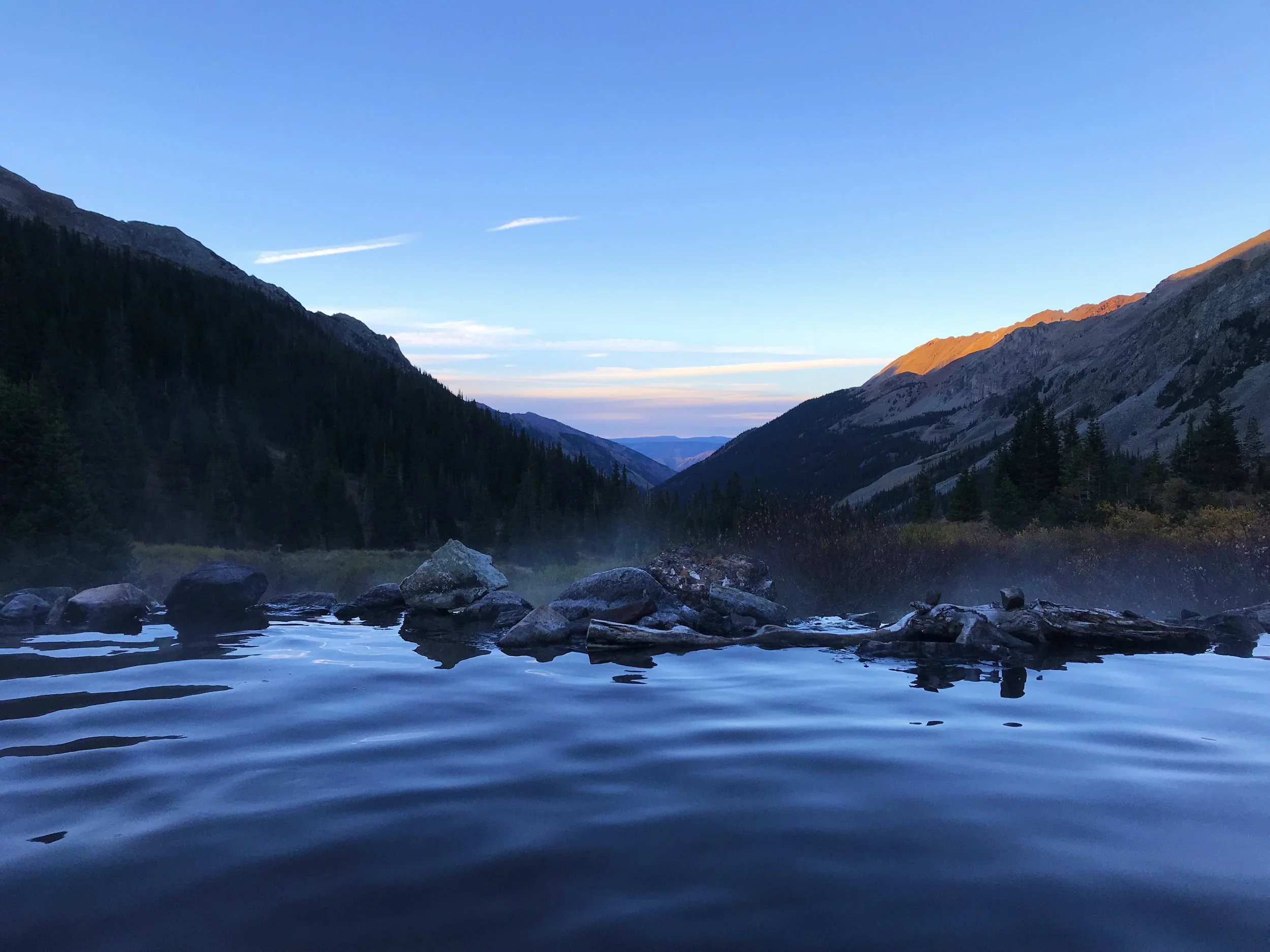
Sunset view from the hot spring
DISTANCE: Approx. 17 miles roundtrip; approx. 2,800 ft elevation gain
DIFFICULTY: Hard
NEED TO KNOW: Permit needed (yes, even if you aren’t camping)
RECOMMENDATIONS: Pack a tent and stay the night; we planned our hike to line up with the turning of the leaves and a full moon—both of these ideas proved awesome.


Behold the cleanest, clearest, freshest alpine lake I’ve ever had the pleasure of swimming in!

Three amigos prepping dinner by the lake


Setting up camp


Golden hour on the way down
DISTANCE: Approx. 13 miles roundtrip to the lake; approx. 2,100 ft elevation gain. Approx. 17 miles roundtrip to the peak; approx. 5,300 ft elevation gain.
DIFFICULTY: Hard
NEED TO KNOW: The hike to Capitol Peak is the most-difficult of the standard 14er routes; It's long, tedious and dangerous. Climbers have died here, including 5 in the Summer of 2017 so don't take it lightly, don't go if you don't have solid Class 3/4 climb skills and don't go just to check this mountain off your list. It's a serious climb you need to be safe.**
That being said, the hike to the lake is a good kick in the butt and absolutely stunning. We camped overnight and I stayed behind at the lake while, much to my protest, the men made there way up and over the knife’s edge and to the tip of Capitol Peak. I also believe there is an easier shorter route to the lake from the back side of Capitol.
RECOMMENDATIONS: I recommend being mellow and not hiking the peak—I had a beautiful time at the lake reading, swimming, and sunbathing (aside from worrying about everyone else and having a front row seat to anything bad that might happen).


DISTANCE: Approx. 5.5 miles roundtrip; approx. 2,000 ft. elevation gain
DIFFICULTY: Hard
NEED TO KNOW: Permit needed for overnight camping, available at trailhead; this hike is quite steep
RECOMMENDATIONS: Camping overnight was great, we were the only ones up there at the time and seeing the sunrise over the lake in the morning was quite enjoyable. I would bring something comfortable to sit on as the lake itself was not super inviting—lots of gnats and murky waters.

Grizzly Lake Trail


Grizzly Lake-Summer

Linkins Lake-Spring

Golden hour at the top of the Pass-Summer

View from campsite at Lincoln Creek-Summer

Lincoln Creek-Fall

View from the road-Fall
GRIZZY LAKE TRAIL
DISTANCE: Approx. 7 miles roundtrip (supposedly); approx. 2,000 ft elevation gain
DIFFICULTY: Moderate
NEED TO KNOW: When you think you’re nearly there, you’re not
RECOMMENDATIONS: Bring plenty of water! It seems that many of the trails in Aspen and the surrounding areas are longer than what is listed on the trailhead marker or the internet. This hike was more difficult and longer than we expected and we ran out of water. But totally beautiful hike that we’re looking forward to doing again.
LINKINS LAKE TRAIL
DISTANCE: Approx. 1.5 miles roundtrip; approx. 530 ft elevation gain
DIFFICULTY: Moderate
NEED TO KNOW: Short, fun hike
RECOMMENDATIONS: Although this is a short hike, the elevation in the Pass makes all of the hikes seem a bit more grueling.
CAMPING/SIGHTSEEING/OTHER HIKES
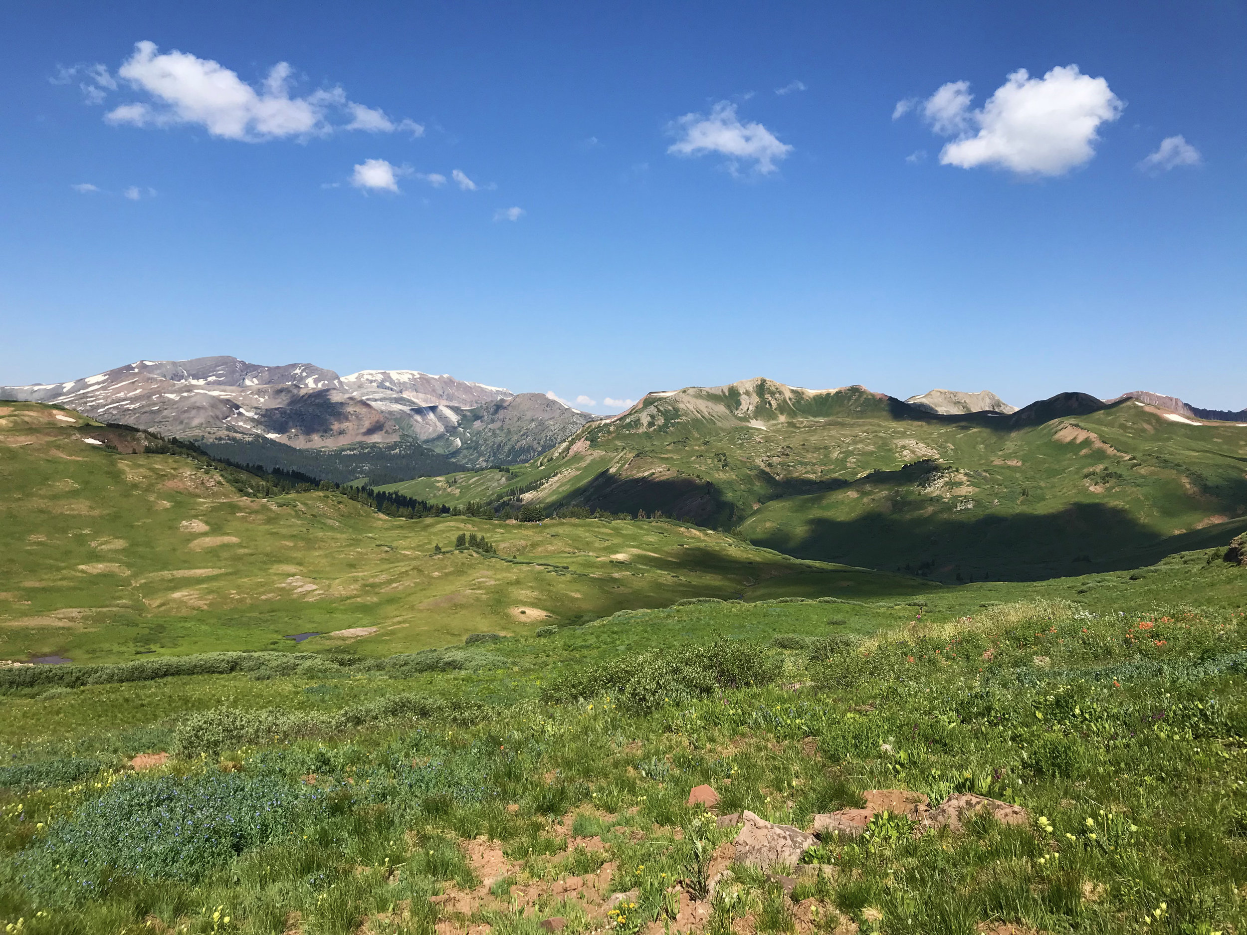
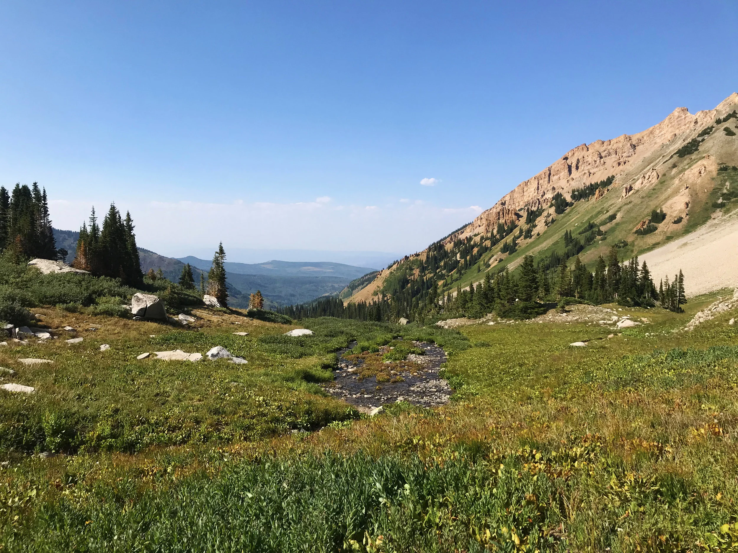
Sadly, the Pass is only open from approximately Memorial Day to Labor Day each year so there’s only so much time to take advantage during the summer and early fall. Driving to the top of the pass is peaceful and scenic and there’s a very short trail to the lookout point that is also lovely. The top is also an incredible spot to watch the annual Perseid meteor shower, which we did and thoroughly enjoyed. We love camping down at Lincoln Creek, there are 22 dispersed campsites to choose from and all/most come with a fire ring and bear box. We look forward to spending more time exploring new areas and hikes next summer and fall—Buckskin Pass, Tom Blake, Electric Pass, Lost Man, and Mount Elbert to name a few!


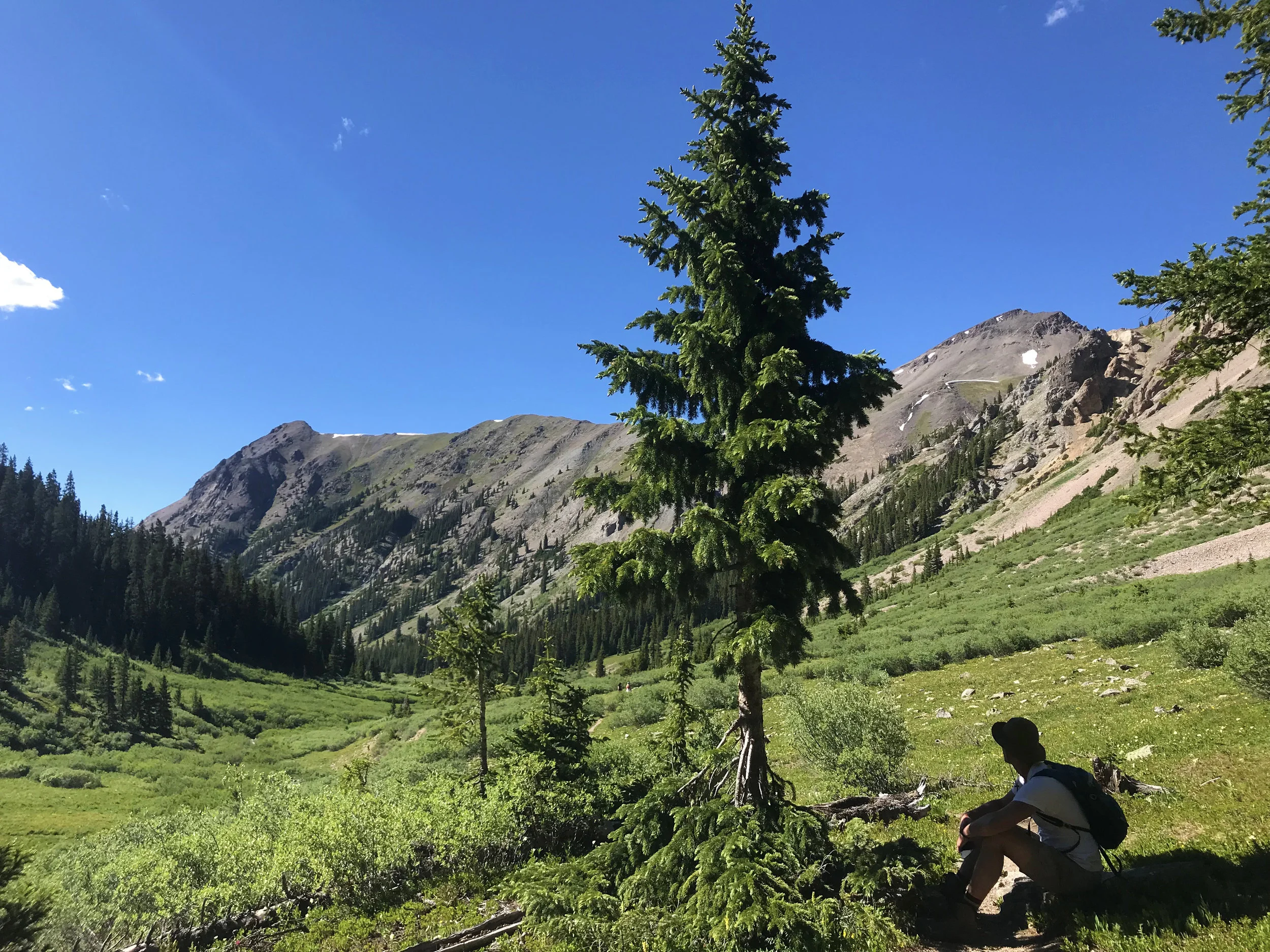
DISTANCE: Approx. 6 miles roundtrip; approx. 2,000 ft elevation gain
DIFFICULTY: Hard
NEED TO KNOW: This lake ain’t for swmmin’ in
RECOMMENDATIONS: Gorgeous hike and lake at the top is emerald green and a beautiful backdrop for a picnic. We saw someone in a hammock and wished we had packed ours.


DISTANCE: Approx. 2 miles roundtrip; approx. 800 ft elevation gain
DIFFICULTY: Moderate
NEED TO KNOW: Teetering on the rock itself may give you vertigo; Great view of Mount Sopris
RECOMMENDATIONS: This hike is a great downvalley (DV) option, it’s quick and easy and the red rocks are a nice change from the Aspen scenery. We love to stop at our favorite DV restaurants whenever we go for this hike.


DISTANCE: Approx. 1.5 miles roundtrip
DIFFICULTY: Moderate-Easy
NEED TO KNOW: This hike is part of a longer Rim Trail hike that we have yet to do; there’s a very cool spiral yin yang at the end that you can probably only see in summer and fall
RECOMMENDATIONS: Wait for the summer and fall months because the trail is pretty muddy in spring, which is when we went. The view at the yin yang spot over Old Snowmass was beautiful but we couldn’t see the yin yang itself under all the snow.


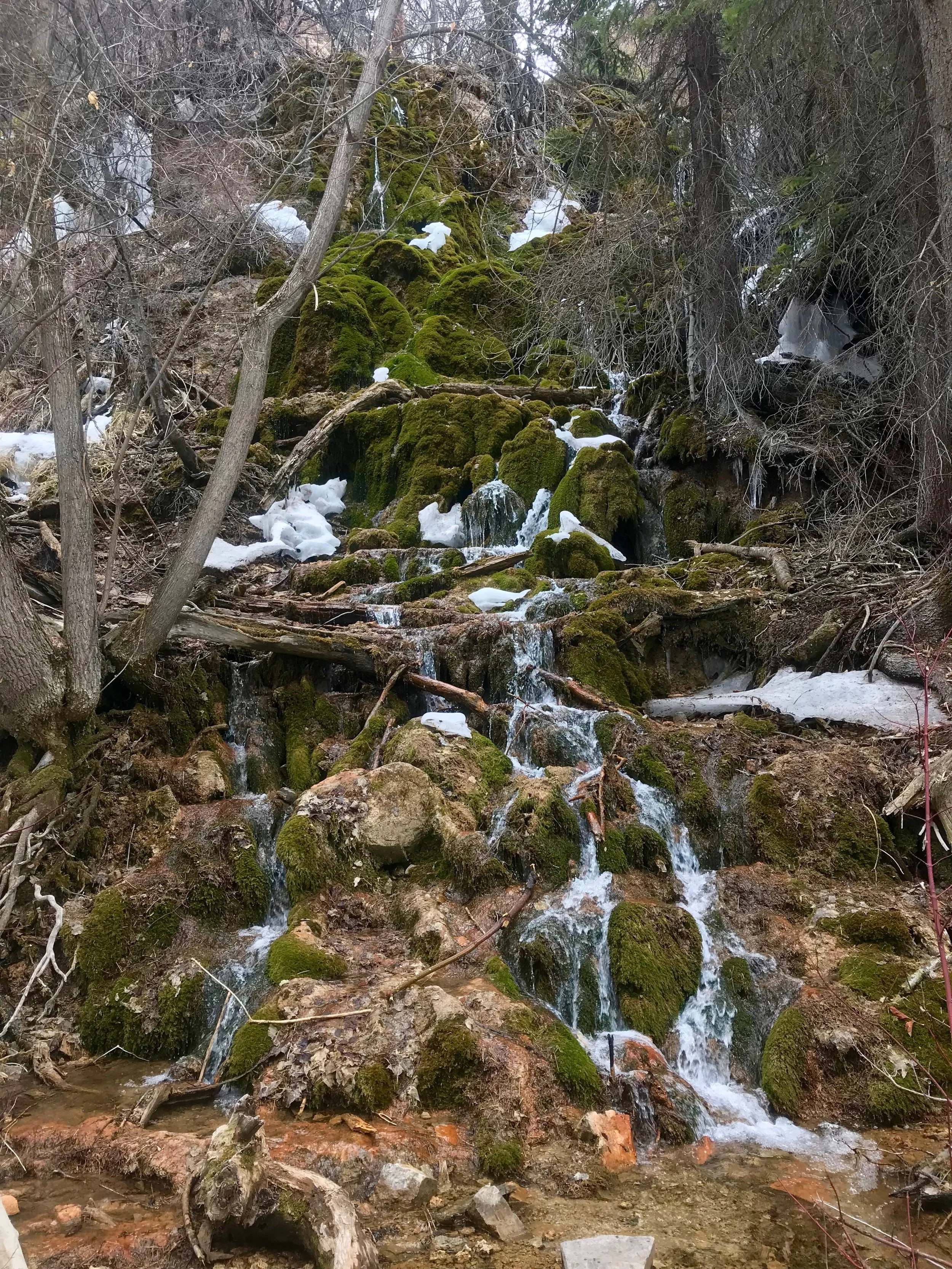

DISTANCE: Approx. 3 miles roundtrip; approx. 1,100 ft elevation gain
DIFFICULTY: Moderate
NEED TO KNOW: Starting May 1, 2019, a permit is now required to visit the lake and the cost is $12/person (May 1 – October 31), $10/person (November 1- April 30). I believe there is also now a shuttle involved which is a total bummer!
RECOMMENDATIONS: Again, we did this hike in the spring and it was still packed with snow and quite slippery. We were given the heads up from a friend to buy some spikes for our sneakers which was clutch advice. The lake looks like Plitvice Lakes in Croatia and the pool in front was a cool emerald color. The Sprouting Rock waterfall behind the lake was also worth checking out.


DISTANCE: Approx. 11 miles roundtrip; approx. 2,700 ft elevation gain
DIFFICULTY: Hard
NEED TO KNOW: They don’t call it sunnyside for nothin’—best to bring a hat and sunblock!
RECOMMENDATIONS: This hike was very rewarding because it’s a bit of a butt-kicker but there are great views and one of the Aspen Swing Project swings at the top. I wouldn’t do this hike in the middle of summer but it would be nice to do it again when there’s less snow on the ground.


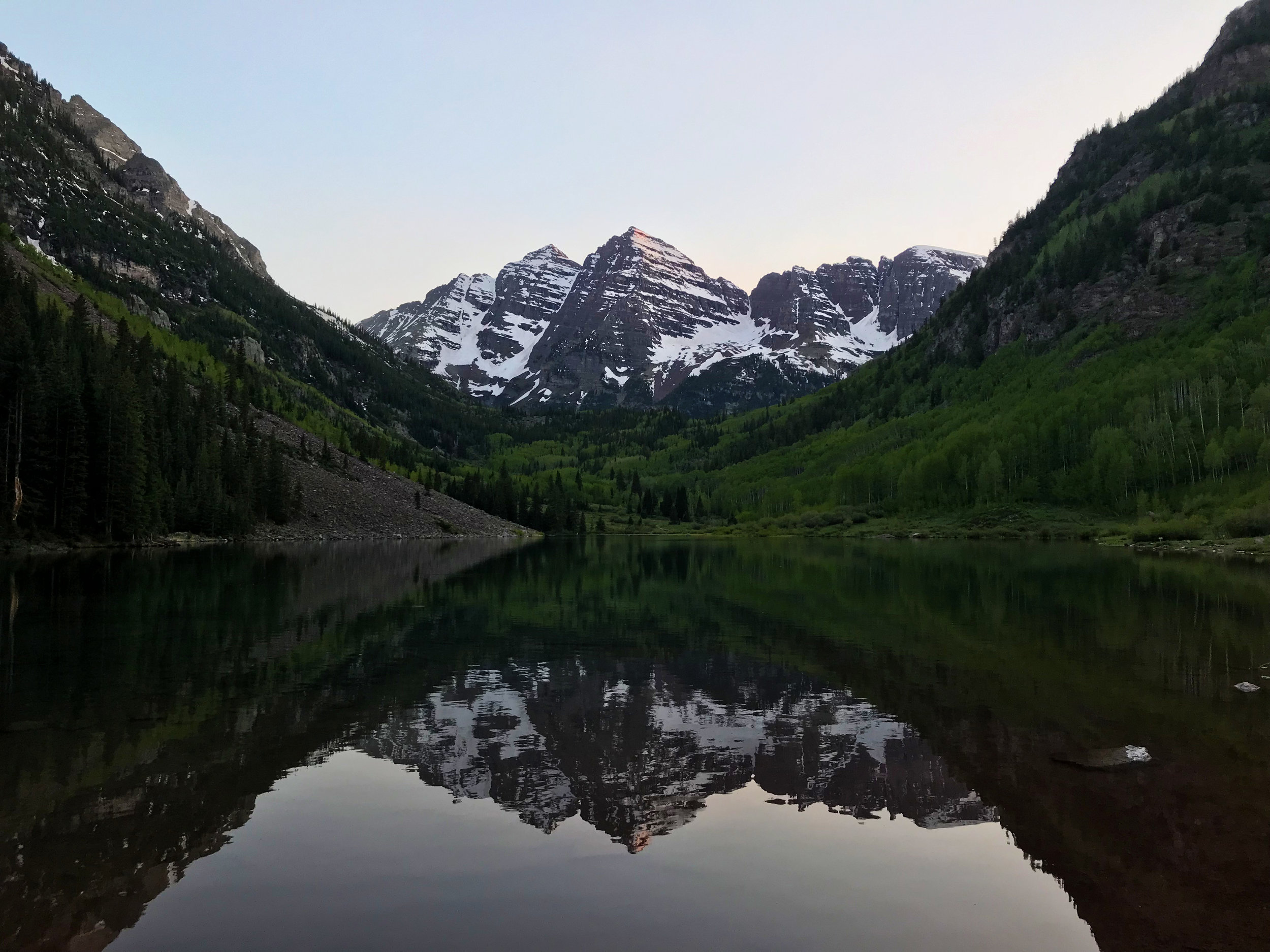
Maroon Bells in Spring
DISTANCE: Approx. 4 miles roundtrip; approx. 700 ft elevation gain
DIFFICULTY: Moderate
NEED TO KNOW: The road to to the Bells is only open to cars outside of winter and the Bells are the most photographed peaks in the country so be prepared for big crowds. In the winter, the only way up is by snowmobile, XC ski, snowshoe or on foot.
RECOMMENDATIONS: I could drive up to see the Bells every day and never tire of them. From Maroon Lake (and the nearby parking lot) the Crater Lake trail is a nice day hike and picnic opportunity, offering a different vantage point than Maroon Lake and (sometimes) fewer people around.


SMUGGLER MOUNTAIN OVERLOOK
DISTANCE: Approx. 3 miles roundtrip to the overlook; approx. 1,000 ft elevation gain
DIFFICULTY: Hard
NEED TO KNOW: Trail is crowded with locals and their dogs (and bikes); the trail also extends farther than the overlook for those looking for more
RECOMMENDATIONS: In the off-seasons I like to hike up to the overlook and run down nearly every day, it’s great for a solid, fast workout. Beware of (human) cougars who won’t move aside for you!
HUNTER CREEK TRAIL
DISTANCE: Depends on where you are starting from
DIFFICULTY: Moderate
NEED TO KNOW: From the Smuggler Overlook you can branch off to this hike that loops around and drops you near the Hunter Creek neighborhood
RECOMMENDATIONS: Bears are probably a consideration in late Spring and early Summer. We went early spring and there was a ton of snow still since it’s in the shade. Fun change of scenery from the Smuggler routine.